
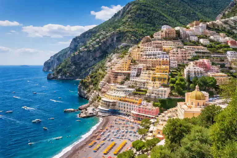
Planning a trip to Italy and searching for the best Amalfi Coast map? You’re in the right place. The Amalfi Coast Italy map is more than just a picture—it helps you understand where everything is, how towns connect, and how to plan your journey smoothly. From famous places like Positano and Amalfi to scenic spots like Ravello, knowing the layout makes travel much easier.
In this guide, you’ll discover a detailed Amalfi Coast map with towns, routes, and travel tips. We’ll also break down distances, transport options, and itinerary maps so you can plan without confusion. Whether it’s your first visit or a return trip, this Amalfi Coast travel guide will help you explore smarter, save time, and enjoy every moment of this stunning coastline.
Quick Answer: Amalfi Coast Map
The Amalfi Coast map shows a stunning coastal region in southern Italy, located along the edge of the Amalfi Coast in the Campania region. It highlights a scenic cliffside route connecting famous towns like Positano, Amalfi, and Ravello, along with nearby gateways such as Sorrento and Salerno.
This map of the Amalfi Coast helps travelers understand how towns are positioned, the distances between locations, and the best ways to move around using driving routes, ferry routes, or bus routes. A detailed Amalfi Coast map with towns and travel times is essential for planning a smooth trip, avoiding long delays, and choosing the best base for your stay.
Where Is the Amalfi Coast on the Map?
The Amalfi Coast map shows a beautiful coastal region in southern Italy, located in the Campania region along the Tyrrhenian Sea. This famous coastline stretches between the gateway towns of Sorrento (west side) and Salerno (east side), forming one of the most scenic routes in Europe.
Distance from Naples
The Amalfi Coast is about 50–60 km (31–37 miles) from Naples. By car, it usually takes 1.5 to 2 hours, depending on traffic. This makes it close enough for a quick trip but still feels unique and separate from the city.
Coastline Layout (Easy to Understand)
The map of the Amalfi Coast follows a curved, cliffside coastline. The road is not straight—it winds along steep cliffs, connecting small towns, beaches, and viewpoints.
- West side: Positano
- Center: Amalfi
- Hills above: Ravello
Map Orientation (West → East Flow)
When reading an Amalfi Coast Italy map, it helps to understand the direction:
- West (start): Sorrento and Positano
- Middle: Amalfi
- East (end): Ravello and Salerno
This west-to-east flow is important for planning routes, choosing the best base town, and avoiding extra travel time.
In simple terms, the Amalfi Coast is a curved coastal strip near Naples, where towns are connected along a scenic road running from west to east.
Amalfi Coast Map Overview (How to Read It Like a Traveler)

You might also like: What to Wear on the Amalfi Coast
Understanding the Amalfi Coast map becomes easy when you look at it like a traveler, not just a map reader. This region is not flat—it’s built along dramatic cliffs, which changes how distances and routes work.
Cliffside Geography Explained Simply
The Amalfi Coast Italy map shows towns sitting on steep cliffs above the sea. This means places may look close on the map, but travel can take longer because of winding roads and elevation.
Coastal Road Structure
The main route is a narrow, scenic road called the coastal drive. It curves along the coastline, passing through towns like Positano and Amalfi. This is why the Amalfi Coast driving route map is so important—it helps you understand the real travel flow.
How Towns Are Connected
All towns are linked in a linear but curved route, not a grid. Some towns, like Ravello, sit above the coast and require uphill travel. Others are directly on the shoreline.
Beginner-Friendly Map Understanding
To keep it simple:
- The coast runs in one main direction (west to east)
- Towns are connected by one primary road
- Travel takes longer than expected due to curves and traffic
This map of the Amalfi Coast is less about distance and more about route experience and terrain.
Amalfi Coast Towns Map (Full Breakdown by Area)
A detailed Amalfi Coast map with towns helps you understand where each place is located and how to plan your trip smartly. Each area has a different vibe and travel advantage.
Western Side (Gateway & Popular Towns)
- Sorrento
This is the main gateway to the Amalfi Coast. It’s well-connected, easy to reach, and often used as a starting point. - Positano
One of the most famous towns on the Amalfi Coast map with attractions, known for colorful cliffside houses and beaches. - Praiano
A quieter alternative to Positano, located between Positano and Amalfi, perfect for a relaxed stay.
Central Area (Heart of the Coast)
- Amalfi
The central hub of the coast. Most routes pass through here, making it a key point on any Amalfi Coast travel route map.
Eastern + Hillside Towns
- Ravello
Located above Amalfi, this town offers stunning views and a quieter atmosphere. It’s slightly off the main coastal road but worth visiting.
Eastern Gateway
- Salerno
A major entry point on the eastern side. It’s well connected by train and ferries, making it a smart starting or ending point.
Amalfi Coast Distance & Travel Time Map
This is where most travelers get confused. On an Amalfi Coast map with towns and distances, places look very close—but in reality, travel takes longer due to curves, traffic, and narrow roads.

Distance Between Towns (Quick Table)
| Route | Distance | Real Travel Time |
| Sorrento → Positano | ~17 km | 40–60 mins |
| Positano → Amalfi | ~16 km | 45–70 mins |
| Amalfi → Ravello | ~7 km | 20–30 mins |
| Amalfi → Salerno | ~25 km | 60–90 mins |
Real Travel Time vs Google Maps
- Google Maps may show shorter times, but actual travel is slower
- Roads are narrow, curved, and busy, especially in peak season
- Expect delays during the summer and on weekends
Traffic Impact (Important)
- High traffic between Positano and Amalfi
- Limited parking in most towns
- Peak hours can double travel time
Best Routes Depending on Time
- Morning: Travel early to avoid traffic
- Midday: Use ferries instead of driving
- Evening: Roads are calmer, better for scenic drives
A detailed Amalfi Coast map with travel times helps you plan realistically and avoid frustration.
Amalfi Coast Transport Map (How to Get Around Easily)
Getting around using the Amalfi Coast transport map is simple once you understand your options. Each method offers a different experience.
Driving Route (Scenic Coastal Road)
Driving along the Amalfi Coast is one of the most beautiful experiences in Italy.
Pros:
- Full flexibility
- Stop at scenic viewpoints
- Explore hidden spots
Difficulty Level:
- Narrow roads with sharp turns
- Heavy traffic in peak season
- Parking is limited
Best for experienced drivers and off-season travel
Bus Route (Budget Option)
The local SITA bus connects all major towns on the Amalfi Coast route map.
Coverage:
- Runs between Sorrento → Positano → Amalfi → Salerno
- Frequent and affordable
Limitations:
- Can be crowded
- Limited space for luggage
- Slower than other options
Best for budget travelers
Ferry Route (Fastest + Scenic Option)
Ferries run along the coast and connect major towns quickly.
Best For:
- Avoiding traffic
- Enjoying sea views
- Faster travel between towns
A ferry routes map is ideal for smooth and stress-free travel
Quick Comparison (Time, Cost, Experience)
| Transport | Time | Cost | Experience |
| Driving | Slow–Moderate | Medium–High | Scenic but stressful |
| Bus | Slow | Low | Budget-friendly but crowded |
| Ferry | Fast | Medium | Scenic + comfortable |
Amalfi Coast Itinerary Map (Smart Travel Planning)
A well-planned Amalfi Coast itinerary map helps you explore more while saving time. The key is to follow a smooth route flow without backtracking.
1-Day Map Route (Quick Trip)
- Start: Sorrento
- Stop: Positano
- End: Amalfi
Best for a quick overview of the coast
2-Day Map Plan (Balanced)
Day 1: Sorrento → Positano → Amalfi
Day 2: Amalfi → Ravello → Salerno
Balanced mix of towns and views
3-Day Itinerary Map (Best Experience)
Day 1: Sorrento + Positano
Day 2: Amalfi + Ravello
Day 3: Relax or explore Salerno / hidden spots
Amalfi Coast Map Itinerary Optimization
Planning with an Amalfi Coast map itinerary is not just about choosing places—it’s about choosing the right order. This is where most travelers lose time.
How to Design Efficient Routes
- Always follow a one-direction route (west → east)
- Start from Sorrento and move toward Salerno
- Visit towns in sequence: Positano → Amalfi → Ravello
This avoids unnecessary backtracking and saves hours
Avoid Tourist Mistakes
- Trying to visit all towns in one day
- Ignoring real travel times on the Amalfi Coast driving route map
- Staying too far from main attractions
Smart Sequencing of Towns
- Day flow: West → Central → East
- Group nearby towns together
- Use ferries for long distances
A smart Amalfi Coast travel route map means less stress and more time to enjoy
Best Base Town on Amalfi Coast Map (Where to Stay)
Choosing the right base on the Amalfi Coast map with towns can completely change your trip experience.
Luxury
- Positano
- Stunning views, high-end hotels, iconic vibe
Budget
- Salerno
- Affordable stays, easy transport, less crowded
Accessibility
- Sorrento
- Well-connected by train, ferry, and road
Map-Based Decision Guide
- Want views → Stay west (Positano)
- Want central location → Stay in Amalfi
- Want easy travel → Stay east (Salerno)
Using an Amalfi Coast map for first-time visitors helps you choose the perfect base quickly
Amalfi Coast Map for First-Time Visitors
If this is your first visit, the Amalfi Coast map explained simply will make everything easier.
How to Navigate Easily
- Follow the main coastal road
- Move in one direction (west → east)
- Use ferries to save time
What Confuses Most Travelers
- Distances look short but take longer
- Roads are narrow and busy
- Towns are built vertically (uphill + downhill)
Simplified Explanation
Think of the Amalfi Coast as:
- One main road
- Towns connected in a line
- Travel based on curves, not straight distance
A beginner-friendly Amalfi Coast map helps you avoid confusion and plan with confidence
Amalfi Coast Map for Different Travel Styles
A smart way to use the Amalfi Coast map with towns is to match it with your travel style. This helps you choose the right areas, routes, and pace.

Luxury Travel Map
- Stay in Positano or near Ravello
- Focus on short distances + scenic viewpoints
- Use ferries or private transfers instead of buses
Best for views, comfort, and iconic experiences
Budget Travel Map
- Base yourself in Salerno or the outer areas
- Use the bus routes on the Amalfi Coast transport map
- Visit major towns as day trips
Best for saving money while still exploring key spots
Slow Travel Map
- Stay longer in one place, like Praiano
- Explore nearby areas slowly
- Avoid rushing between towns
Best for a relaxed, stress-free experience
Amalfi Coast Travel Time & Distance Analysis
Understanding travel time vs distance is key when using an Amalfi Coast map with travel times. This adds real planning value and helps avoid common mistakes.
Seasonal Traffic Differences
- Summer (June–August): Heavy traffic, slower travel
- Shoulder season: Moderate traffic, smoother experience
- Off-season: Fastest travel, fewer crowds
Time vs Distance Logic
- Short distances can take longer than expected
- Roads are curved, narrow, and busy
- Elevation changes affect travel speed
Example: 15–20 km may take 45–70 minutes
Travel Efficiency Tips
- Start early in the morning
- Use ferries for longer routes
- Avoid peak midday traffic
A realistic Amalfi Coast map itinerary always considers time, not just distance
Amalfi Coast Scenic Viewpoints & Photo Spots Map
A detailed Amalfi Coast map with attractions should always include the best photo spots. These locations are perfect for views, relaxation, and memorable moments.
Sunset Viewpoints
- Positano cliffs
- Ravello terraces
Instagram Locations
- Colorful streets of Positano
- Amalfi Cathedral area in Amalfi
- Scenic coastal road viewpoints
Scenic Stops Along the Route
- Coastal drive viewpoints between towns
- Hidden overlooks along the main road
- Quiet spots with sea views
These are must-add points on any Amalfi Coast scenic road map
Hidden Gems on the Amalfi Coast Map
Beyond the famous towns, the Amalfi Coast’s hidden gems map reveals quieter places that most tourists miss.
Quiet Towns
- Praiano – peaceful and less crowded
- Atrani – small and authentic
Secret Beaches
- Fiordo di Furore – hidden between cliffs
- Smaller beaches away from main towns
Off-Route Locations
- Hillside areas above Amalfi
- Scenic paths not on the main tourist route
Adding these to your Amalfi Coast map for first-time visitors gives you a more unique and relaxed experience.
Amalfi Coast Seasonal Map Guide
The Amalfi Coast map with travel times changes depending on the season. Understanding this helps you plan smarter and avoid delays.
Summer vs Off-Season Travel
- Summer (June–August): Very crowded, longer travel times, busy towns
- Spring & Fall: Best balance of weather and manageable crowds
- Winter (Off-season): Quiet, peaceful, but fewer services
The same route on an Amalfi Coast driving route map can take twice as long in summer
Ferry Availability Changes
- Summer: Frequent ferry routes connecting major towns like Positano and Amalfi
- Off-season: Limited or reduced ferry schedules
Always check the Amalfi Coast ferry routes map before planning
Traffic Variation
- Peak hours: Late morning to evening
- Less traffic: Early morning or late evening
- Coastal road congestion is highest between Positano and Amalfi
A season-aware Amalfi Coast map itinerary helps you avoid major delays
Amalfi Coast Logistics Map (Parking, Access & Restrictions)
The Amalfi Coast logistics map is something most guides ignore—but it’s very important for a smooth trip.
ZTL Zones Explained
Many towns, including Amalfi and Positano, have ZTL (Limited Traffic Zones).
- Only residents or authorized vehicles can enter
- Fines apply if you enter without permission
Parking Difficulty Areas
- Parking is very limited in popular towns
- Positano has steep, limited parking spots
- Amalfi town parking fills quickly
Always park outside town centers when possible
Entry Restrictions
- Some roads restrict vehicle types during peak season
- Narrow streets are not suitable for large cars
- Traffic rules may change seasonally
A detailed Amalfi Coast map with access rules helps avoid stress and fines
Hidden Routes & Alternative Paths (Local Secrets)
Using an Amalfi Coast travel route map, you can find smarter ways to avoid crowds and enjoy peaceful views.

Avoid Crowded Roads
- Skip peak hours on the main coastal road
- Travel early morning or late evening
Local Shortcuts
- Routes through hillside towns like Ravello
- Alternative paths away from the busiest coastal sections
Scenic Detours
- Quiet roads above the coastline
- Less crowded viewpoints with amazing views
- Hidden stops between major towns
These routes are perfect for travelers looking for a calmer Amalfi Coast experience
Common Mistakes When Using the Amalfi Coast Map
Even with a detailed Amalfi Coast map, many travelers make simple mistakes that affect their trip.
Underestimating Travel Time
- Distances look short, but take longer
- Traffic and curves slow down travel
Choosing the Wrong Base
- Staying too far from the main attractions
- Not considering transport options
Driving Challenges
- Narrow roads and sharp turns
- Limited parking
- Stressful driving in peak season
FAQs About the Amalfi Coast Map
Where is the Amalfi Coast on the map?
The Amalfi Coast map shows a coastal region in southern Italy, located in the Campania region along the Tyrrhenian Sea. It sits between Sorrento and Salerno, not far from Naples.
How far are Amalfi Coast towns from each other?
On a map of the Amalfi Coast, towns appear close, but travel takes longer due to winding roads. For example:
- Positano → Amalfi: about 45–70 minutes
- Amalfi → Ravello: about 20–30 minutes
Always rely on a detailed Amalfi Coast map with travel times, not just distance
What is the best way to travel on the Amalfi Coast?
The best option depends on your style:
- Ferry: fastest and scenic
- Bus: budget-friendly
- Driving: flexible but challenging
A good Amalfi Coast transport map helps you choose the right option
Is driving on the Amalfi Coast difficult?
Yes, driving can be challenging. Roads are narrow, curved, and often crowded, especially in summer. Parking is limited, and traffic can slow you down.
Many travelers prefer ferries or buses based on the Amalfi Coast driving route map
Which town is best to stay on the Amalfi Coast?
- For views: Positano
- For central location: Amalfi
- For budget & access: Salerno
Use an Amalfi Coast map with towns to choose the best base for your trip
Conclusion
The Amalfi Coast map is more than just a visual—it’s your complete travel planning tool. It helps you understand where towns are located, how routes connect, and how to move efficiently along the coast. From Positano to Ravello, every location becomes easier to explore when you know the layout.
By using a detailed Amalfi Coast map with towns, routes, and travel times, you can avoid common mistakes, save time, and enjoy a smoother experience.
Final tip: always plan your route in one direction, check travel times instead of distance, and choose your base wisely. This simple strategy will make your Amalfi Coast trip stress-free and unforgettable.